BLACK DOME CHALLENGE
Asheville, North Carolina
Developed by Rockgeist Bikepack USA

Stats
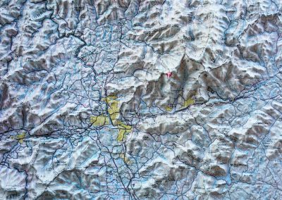
102 miles, 10,657 ft elevation gain, 91 ft/mi. Route strongly recommended clockwise as shown.
Difficulty
Challenging due to distance and elevation gain.
Terrain
Pavement (mostly Blue Ridge Parkway), gravel. Preferred bike rank: Gravel bike, road bike if you take route 80 off the BRP.
Camping
Established campgrounds or options of primitive, backcountry camping (no reservations needed).
Number of Nights
1 night ideal.
Food & Water
Resupply options at Mt. Mitchell in season, then lots of options day 2. Plenty of water to filter.
Bikepacking the Black Dome Challenge
Black Dome Challenge starts with a wheel dip in the French Broad River, the lowest point in Asheville, then climbs up to the summit of Mount Mitchell, the highest mountain on the East Coast. Camp out at Mt. Mitchell’s summit or right of the Blue Ridge Parkway on Curtis Creek. Your scenic tour of Western NC continues as you bike through Marion, Old Fort, Black Mountain, and finally conclude your trip by traveling though Asheville’s River Arts District.
Highlights
- Blue Ridge Parkway riding
- Brewery stops (Black Mountain, Asheville)
- Camping at the highest summit on the East Coast.
Trip Beta
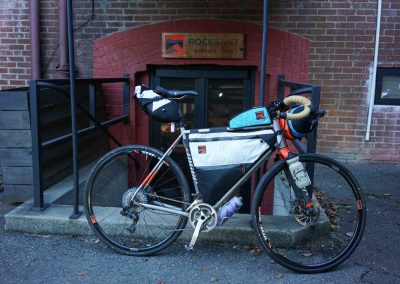
The trip starts at the Rockgeist workshop in Woodfin, just a few miles north of downtown Asheville. (Please email [email protected] to coordinate overnight parking at the workshop.) There is a great coffee shop next to the workshop right on the French Broad River; so grab your coffee and dip your rear wheel in the River for the official start. Its all uphill from here as you bike up Elk Mountain Road and make your way over to Webb Cove Rd, which is the start of a smooth gravel climb up to the Blue Ridge Parkway.
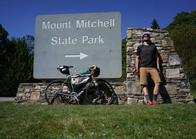
The climbing has just begun as your make your way through the tunnels, pass countless vistas, and arrive at the Craggy Gardens Visitor Center for the first water re-supply. Fill up your bottles then continue on to the entrance of the Mount Mitchell State Park. Don’t get too excited as you see the Park’s entrance; it’s another 4 miles up to the summit.
Before arriving at the summit you’ll first pass the visitors center, restaurant, and camping area. You’ll need to walk the last 80 yards to the top but the journey is well worth the views that await. For camping you have two options. Reserve (well) in advance for camping at the summit, sites 5 and 6 have the best views to the East, with site 5 having the best hammock set up. The next morning descend back to the Parkway where you’ll soon arrive at the Curtis Creek gravel descent into Old Fort. Along Curtis Creek is the second camping option which is more readily available. If you have small road tires then we recommend you continue on to descend an equally as fun option along route 80 but this will skip over the camping option.
Once the route turns back west just outside Old Fort you have relatively flat terrain until you arrive at the Old Highway 70 greenway climb. This tops out at the popular Kitsuma Trailhead where you’ll continue West into Black Mountain where we recommend to stop at Dynamite Roasting or Pisgah Brewing for your choice of drink. Next up you’ll pass through Warren Wilson College and into East Asheville. The route now jumps back on the Blue Ridge Parkway for the most scenic option to get back to Rockgeist but feel free to make the route your own and explore the city before returning to your vehicle.
Additional Information/camping options:
- If you need any bikepacking gear check out the Rockgeist rental gear selection.
- This is a big route to tackle in a single overnight. If you’re looking to spend more time camping you may want to consider taking two nights; the first at Mt. Mitchell State Park campground and the second at Catawba Falls Campground. Both campgrounds can fill up fast so it’s best to reserve your sites in advance.
- Take note of the Curtis Creek gravel road off the Parkway (heading north from Mt. Mitchell). Camping along Curtis Creek is much easier to get compared to reserving a site on Mt. Mitchell.
2 Comments
Submit a Comment
Terms: Routes on Rockgeist.com are partial planning resources only, primarily for providing potential locations and initial mapping, and may not cover trail surface and challenge details. Please complete your own research before starting your trip. These routes are often remote and require proper knowledge of safety; including bike repair, bail out options, navigation, and resupply locations. Additionally, because of the remote nature of these locations, you may not have access to wireless or cellphone when onsite. You should also be aware of and prepared for weather and conditions. Users are required to obey all road, land, and trail rules, while practicing Leave No Trace principles. While all routes are diligently prepared and presented, Rockgeist does not guarantee accuracy of routes, trail conditions, or any points of interest detailed herein. It is your intention to fully assume all risks when following these routes. Rockgeist LLC, its collaborators, partners, or volunteers are in no way liable for actions, personal injury, damage to property, or any events that arise directly or indirectly from the routes presented on Rockgeist.com.










hello!
my name is dave. i’m a bicycle courier living in durham. i’m looking for beta for an itt on black dome. kinda new to mountain biking, but im rocking a kona unit decked out with rockgeist bags + a mr fusion seat pack. i guess i’m just wondering what is does a fast time look like on the route? pack light??
Hey Dave! 24 hours would be a fast time, but much of that would be spent at camp. Due to elevation gain, packing light always helps! hope you have fun!