THE GRAVEL RING
Fort Valley VA, George Washington National Forest
Developed by Barry C.

Stats
67 miles, 7,421 ft elevation gain, 110 ft/mi. Route ridden counter-clockwise.
Difficulty
Challenging due to elevation gain and sections of hike-a-bike.
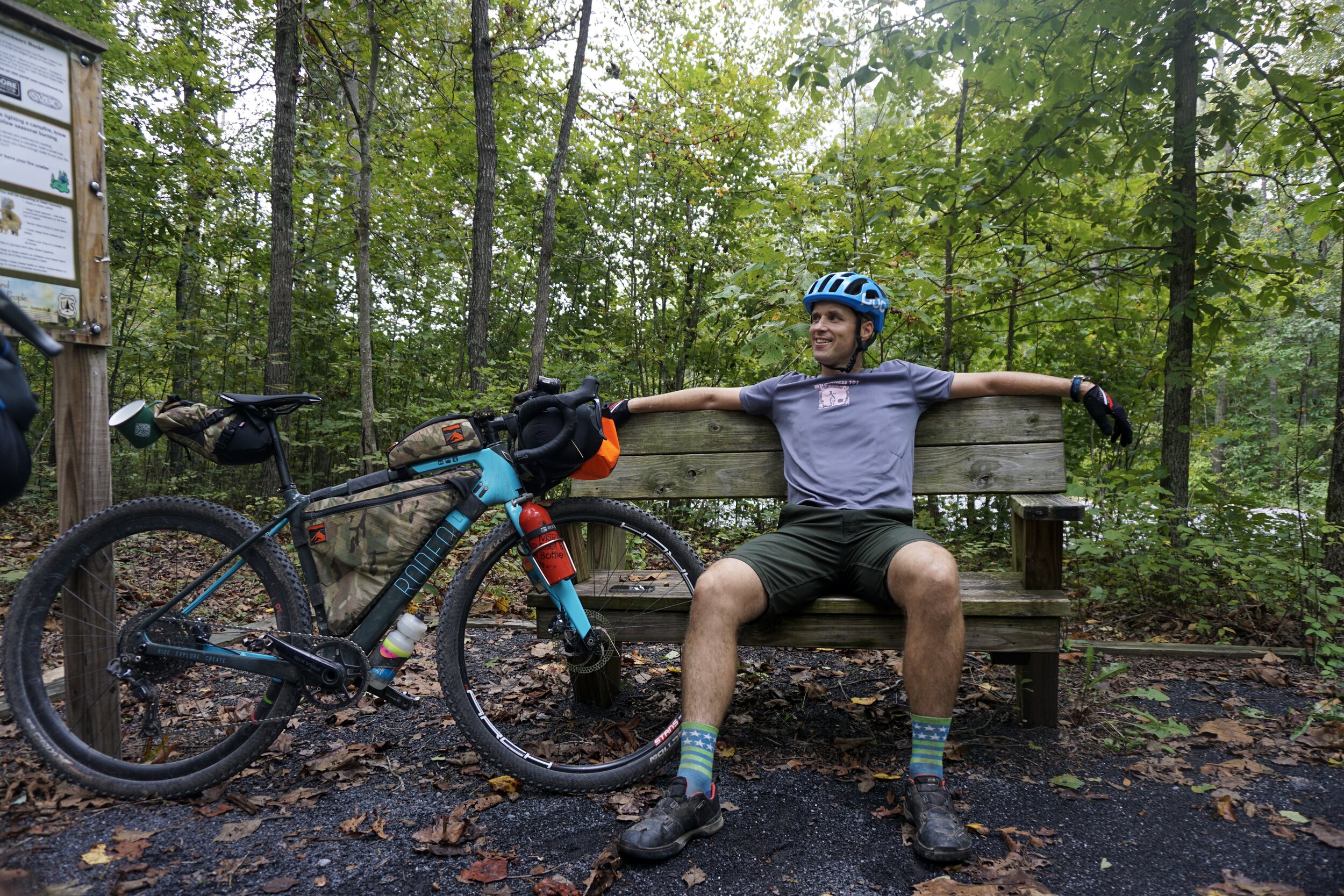
Terrain, Bike Choice
Gravel, pavement, double track, singletrack. Preferred bike rank: Rigid MTB, Gravel bike, hardtail.
Camping
Primitive, backcountry camping and developed options.
Number of Nights
1 night is ideal.
Food & Water
Resupply towards the end of day 2. Pack a water filter.
Bikepacking the Gravel Ring
The Gravel Ring circumnavigates the Massanutten formation in Fort Valley, Virginia and offers a mixed terrain variation of the “The Ring” (a more rough-and-rocky version using the Massanutten Trail). While The Gravel Ring is passable on skinny-tired gravel bikes, most riders will appreciate fat tires on the three rough singletrack climbs and two singletrack descents. Primitive camping is availble along most of the route in the George Washington National Forest.
Highlights
-
Valley, Ridge, and Shenandoah River views
-
Woodstock Lookout Tower
-
Two epic passes across the Massanutten ridge
-
The Fort Valley Store
-
Primitive and developed campsites
Trip Beta
The route starts at the Elizabeth Furnace Family campground at the northern end of Fort Valley in Northern Virginia. Riders can either park for free across the street or just up the road at the Signal Knob hiking lot. After climbing a double-track fire road for several miles you’ll encounter your first taste of Massanutten rocks along the Mudhole Gap trail. Several tricky sections, including four creek crossings, might have you pushing your loaded bike so wear sturdy shoes. You’ll be rewarded with some pristine gravel once you reach Powell’s Fort Camp. Be sure to fill up at the piped spring just a quarter mile north along Boyer Road.
You’ll spend the next half hour slowing climbing towards Mine Mountain on lightly-traveled gravel roads. If you’ve never been up the firetower, be sure to make the mile climb up Woodstock Tower Road before reaching Little Fort Campground and Peter’s Mill Rd. Peter’s Mill Rd. will throw a little of everything at you: dirt, sand, rocks, and shale. Be sure to watch out for other off-highway traffic, as it’s a popular spot for ATVs on the weekends. After a long, and sometimes bumpy climb you’ll be rewarded with a steep and fast descent to Edinburg Gap. Another natural piped spring is available on Edinburg Gap road, about 3/4 mile east off the route. There is also a pit toilet and large gravel parking lot if you need a place to crash for a while.
On the south side of Edinburg Gap you’ll pick up FR-374, another lightly traveled fire road that climbs and descends towards Moreland Gap. Turn east on Moreland Gap road, and enjoy a fast and relatively smooth descent towards Camp Roosevelt, a good place for your overnight stay. During the summer months there is camping, water and a bathroom available at Camp Roosevelt. There is also primitive camping just up the road at the horse trailer parking lot year around.
On the second morning head uphill on the pavement towards Kennedy Peak, and be sure to take in the views of the Shenandoah River Valley before bombing down to Egypt Bend. Turning north on Page Valley Road, the terrain will alternate between short and steep climbs and long stretches along the Shenandoah River in Burner’s Bottom. Be sure to not miss the left turn towards Milford Gap–there is no other way to exit Page Valley Road on public property. Once headed uphill, the gravel road will quickly turn to doubletrack, then to steep singletrack straight towards the Massanutten Ridge. Once you reach the ridge, cross the Massanutten Trail and head immediately downhill, heading west. You’ll get a ripping fast gravel road descent that will lead you back towards Fort Valley. Head into town at Seven Fountains and stop at the Fort Valley Country Store for some well-earned homemade grub.
Once you’ve eaten your fill, head north on Fort Valley Road for a few miles to Veech Gap. Fort Valley Road is narrow and windy, so keep to the right and watch for traffic. Veech Gap will again start as road, then doubletrack, then singletrack, and then you’ll be walking again, albiet it briefly until you reach Little Crease. Ride the Massanutten Trail uphill (south) as long as you can, then push to the ridge. You’ll again bomb down the other side back to Panhandle Rd and the South Fork of the Shenandoah. From here, rolling dirt and gravel roads will bring you around the north end of Fort Valley and back to your starting point.


4 Comments
Submit a Comment
Terms: Routes on Rockgeist.com are partial planning resources only, primarily for providing potential locations and initial mapping, and may not cover trail surface and challenge details. Please complete your own research before starting your trip. These routes are often remote and require proper knowledge of safety; including bike repair, bail out options, navigation, and resupply locations. Additionally, because of the remote nature of these locations, you may not have access to wireless or cellphone when onsite. You should also be aware of and prepared for weather and conditions. Users are required to obey all road, land, and trail rules, while practicing Leave No Trace principles. While all routes are diligently prepared and presented, Rockgeist does not guarantee accuracy of routes, trail conditions, or any points of interest detailed herein. It is your intention to fully assume all risks when following these routes. Rockgeist LLC, its collaborators, partners, or volunteers are in no way liable for actions, personal injury, damage to property, or any events that arise directly or indirectly from the routes presented on Rockgeist.com.
Thanks for publishing this great route which I did in a day, but agree with the comment from Gilbert Torres that there is a lot of bike pushing to do up the rocky single track, so plan accordingly in terms of time needed to complete the ride. Also I am pretty sure the Fort Valley country store is incorrectly marked on the gpx track, so you need to go off the route to buy provisions.
Finally, access to water on the second half of the loop is limited. Yes, quite an adventure! Thanks again.
Hey Paul! thanks for the feedback, sounds like doing this in a single day is a big ride! We added those details up above and confirmed the right spot for the store. Thanks!
Hola, my friend Phil and I did ‘The Gravel Ring’ but I think it should be called ‘The Gravel/boulder Ring’. For sure this is better ridden on a MTB. We did on Gravel bikes with 35mm tires, fully loaded and self supported. We did underestimated the amount of of the saddle pushing the bikes up the rocky climbs. We did not cursed you out, we were in good sprit and happy to be there surrounded by all the nature and beauty this ride has. Luckily for us we saw many good people on the remote parts of the trails on house and motor bikes. Also, we had many how did attend our need for water. God bless the nice guy at the camp ground and the owner of the chicken farm with the twin towers. Over all this is am EPIC Ride. If someone need a good adventure this is one ride to add to your portfolio. We will come back with a modified version of the route, Thank you for giving us an opportunity of this adventure.
Glad you guys made it out! We have since added a quick view guide giving all the relevant info up top on the page (to all of our routes now). Hopefully this will help people plan better and have more accurate expectations. Thanks for this feedback!