
Stats
29 miles, 4,745 ft elevation gain, 163 ft/mi. -Clockwise direction suggested.
Difficulty
Intermediate due to elevation gain and technical trail sections.
Terrain, Bike Choice
Singletack, double track, gravel. Preferred bike rank: hardtail, full suspension mountain bike
Camping
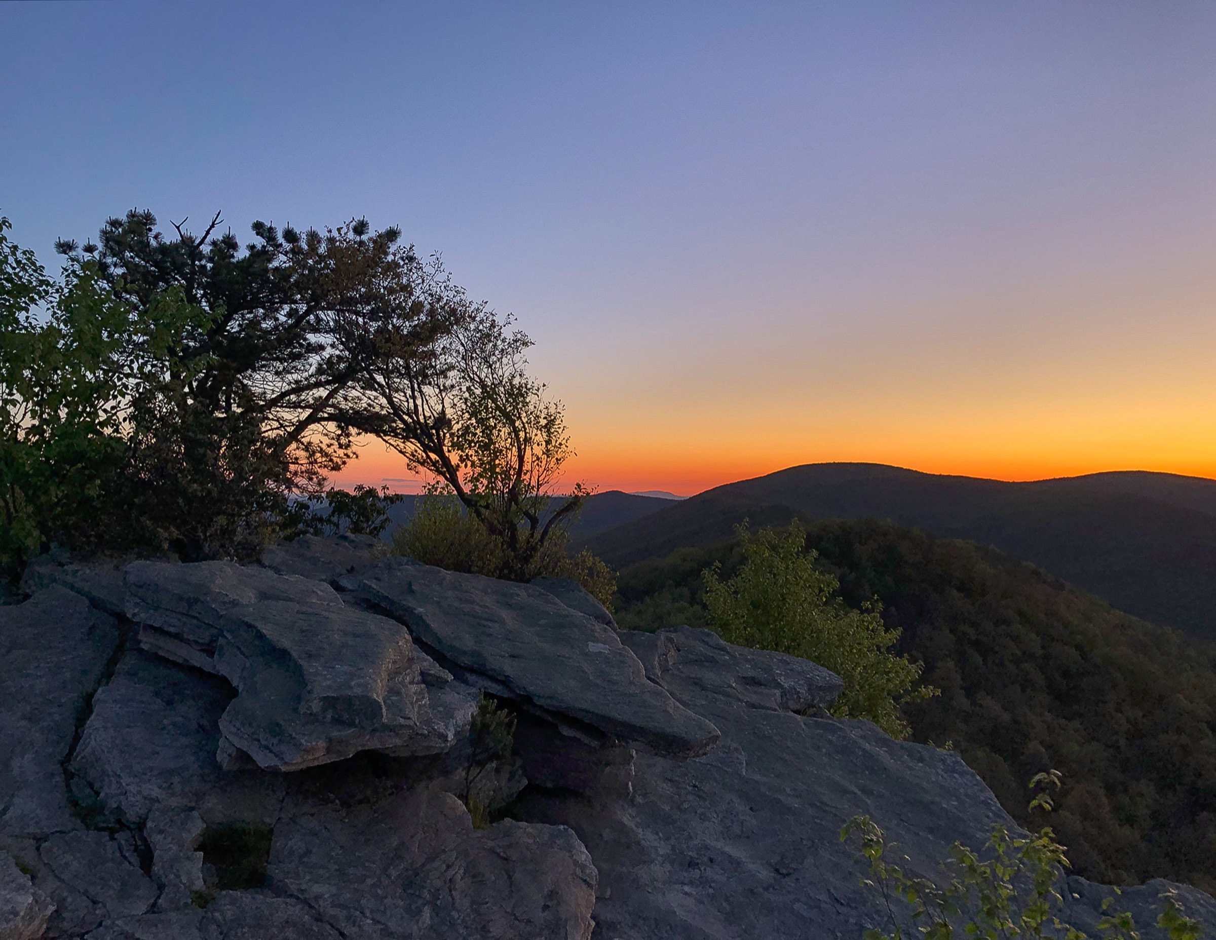
Primitive, backcountry camping at (or near) the overlook.
Number of Nights
1 night.
Food & Water
No resupply options, pack all food and bring a water filter.
Bikepacking Big Schloss
A great sub-24 hour overnight (S24O) with the highlight of camping near or at the Big Schloss overlook. There a number of great vistas along the way with rocky singletrack, creek crossings, and plenty of primitive campgrounds to choose from.
Highlights
- Big Schloss overlook camping
- Ridgleline singletrack
- Creek crossings
Trip Beta
TRIP GALLERY
Photos: Nick Curren


Terms: Routes on Rockgeist.com are partial planning resources only, primarily for providing potential locations and initial mapping, and may not cover trail surface and challenge details. Please complete your own research before starting your trip. These routes are often remote and require proper knowledge of safety; including bike repair, bail out options, navigation, and resupply locations. Additionally, because of the remote nature of these locations, you may not have access to wireless or cellphone when onsite. You should also be aware of and prepared for weather and conditions. Users are required to obey all road, land, and trail rules, while practicing Leave No Trace principles. While all routes are diligently prepared and presented, Rockgeist does not guarantee accuracy of routes, trail conditions, or any points of interest detailed herein. It is your intention to fully assume all risks when following these routes. Rockgeist LLC, its collaborators, partners, or volunteers are in no way liable for actions, personal injury, damage to property, or any events that arise directly or indirectly from the routes presented on Rockgeist.com.
0 Comments