ARTS AND CRAFTS
Hot Springs, North Carolina
Developed by McHone Performance Training

Stats
29 miles, 2,678 ft elevation gain, 94 ft/mi. Route ridden clockwise but either direction works.
Difficulty
Light. A beginner friendly route with smooth terrain and moderate elevation gain.
Terrain
Gravel, greenway pavement, and country roads. Preferred bike rank: Gravel bike, Rigid MTB, Hardtail.
Camping
Established campgrounds, reservations encouraged.
Number of Nights
1 night ideal.
Food & Water
Resupply options only at start and finish in Hot Springs.
Bikepacking Arts and Crafts
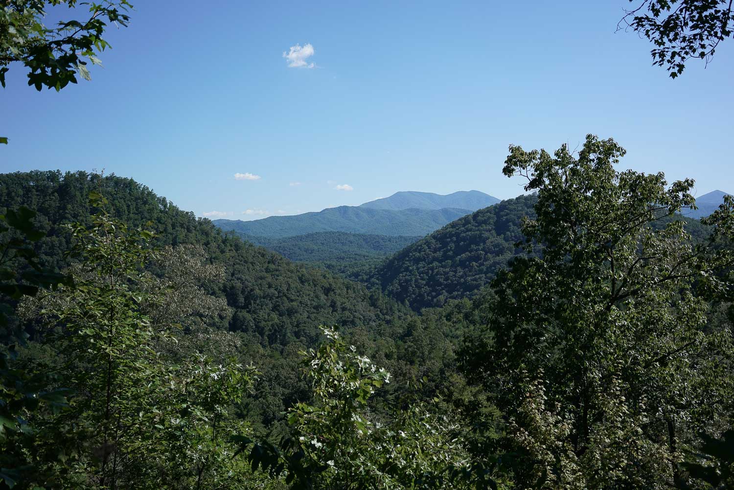
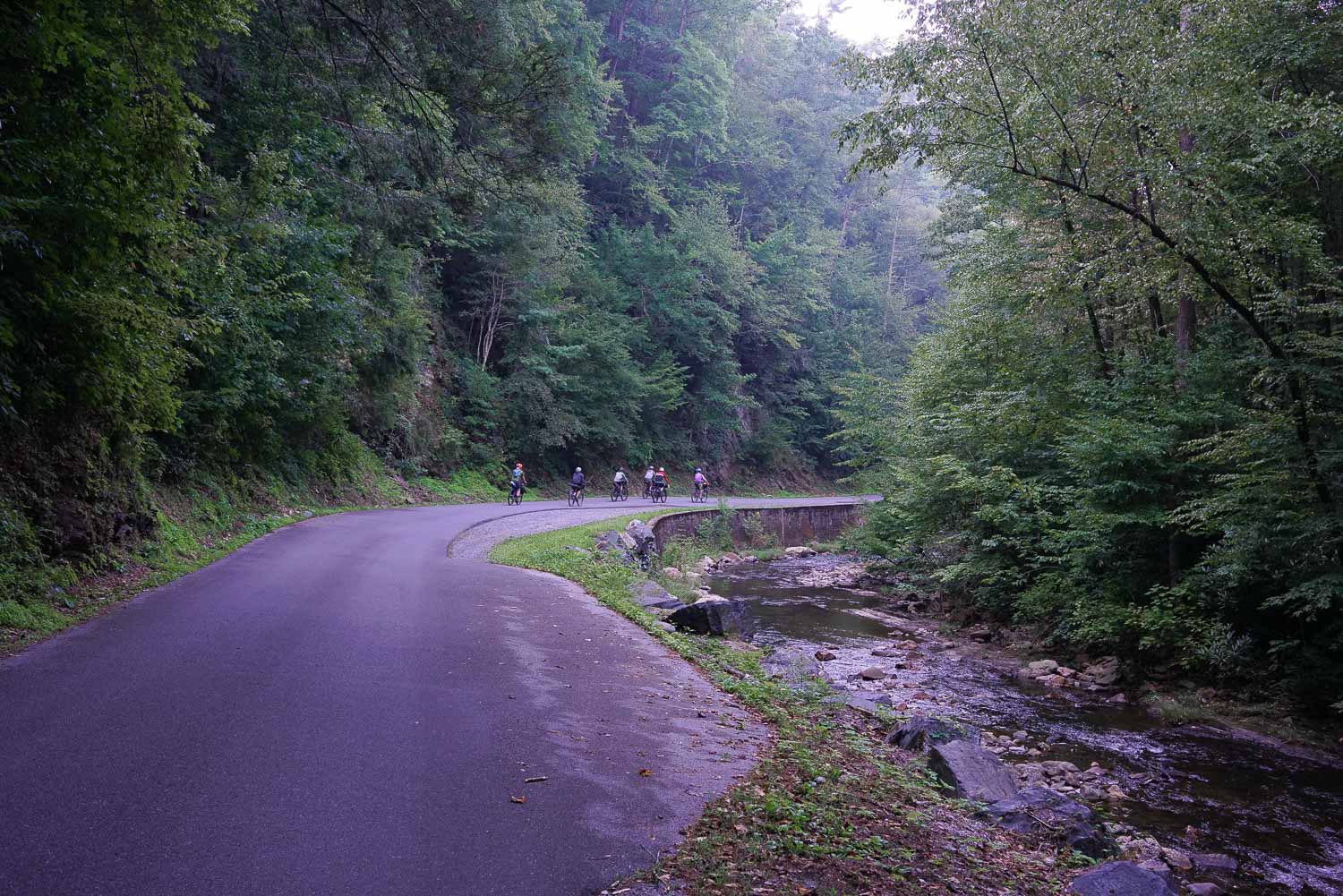
Arts and Crafts is a beginner friendly route leaving from Hot Springs, NC staying at the the Paint Creek Campground. The terrain is smooth gravel, greenway pavement, and country roads allowing bike trailers and beginner bikepackers to join in. Highlights include easy riding along the French Broad River, swimming at Dudley Falls, and a soak in the hot springs before or after your ride.
Highlights
- Riverside gravel riding
- Hot springs soak
- Swimming at Dudley Falls
- Petroglyphs on Paint Rock
Trip Beta
The route leaves from the Appalachian Trail parking area and rolls through the hiking town of Hot Springs, NC. The first sections follows the French Broad River north towards the Paint Rock landmark. Paint Rock gets its name from the discovery of painted images on the face of the rock which date back to approximately 2500 B.C. To see the petroglyphs, find the cliff face where the route takes a sharp right away from the French Broad River. Look up about 20-30 feet on the rock face to find faint geometric and swirly markings on the rocks.
Once ready, begin your gravel climb away from the French Broad which tops out at the Paint Mountain Trailhead. Next, enjoy your descent to Houston Valley Road where you have a smaller, paved climb to the Paint Creek Campground. After setting up camp there is good swimming at Dudley Falls (which you will also pass on the way out) or you can explore tails and smaller creeks closer to the campground. Leaving from the campground take Lower Paint Creek Road all downhill back towards the French Broad River where you’ll follow the gravel back into town. More East Coast S240 routes can be found on our Routes Page.
Additional Information:
- Paint Creek Campground is first come, first served. It’s recommended to arrive early on summer weekends. ($10 for a tent site)
- If you’re looking for lodging before or after your ride, Hot Springs Resort and Spa has a campground on the river ($30-35 for tent sites). They also offer hot tubs filled with water from the hot springs starting at $25.


4 Comments
Submit a Comment
Terms: Routes on Rockgeist.com are partial planning resources only, primarily for providing potential locations and initial mapping, and may not cover trail surface and challenge details. Please complete your own research before starting your trip. These routes are often remote and require proper knowledge of safety; including bike repair, bail out options, navigation, and resupply locations. Additionally, because of the remote nature of these locations, you may not have access to wireless or cellphone when onsite. You should also be aware of and prepared for weather and conditions. Users are required to obey all road, land, and trail rules, while practicing Leave No Trace principles. While all routes are diligently prepared and presented, Rockgeist does not guarantee accuracy of routes, trail conditions, or any points of interest detailed herein. It is your intention to fully assume all risks when following these routes. Rockgeist LLC, its collaborators, partners, or volunteers are in no way liable for actions, personal injury, damage to property, or any events that arise directly or indirectly from the routes presented on Rockgeist.com.
Just tried this route yesterday as a day trip in the sunny February weather. **Limited cell service on the route.** I parked at the free public lot to the right just as you get into Hot Springs from Asheville, it says overnight parking okay if you notify the number on the sign. Really smooth riding along the French Broad without many cars, but you can also park at the Paint Rock landmark if you wanted to focus on the climbing or cut some miles. A beautiful climb up from the river with big views in the winter and river views at the beginning, this is also a very quiet road, smooth gravel and hardly even muddy even after the weeks of rain we’ve had. Upon the advice of a stranger, I tried my hand at the single track trail that seems to cut the loop in half- be very weary of that trail! (I believe it is called Paint Rock Trail #7, blue on the map above). Marked as “intermediate” on the trail sign but definitely expert level, coming from someone who considers themself to be an intermediate rider. Not much climbing, but between the very narrow trail, steep drop to the side as it hugs the mtn, and near constant roots and rock challenges, I found myself hike-a-biking for nearly 80% of it, not wanting to risk a bad fall or sprained ankle on such a remote ride. Also, it is not super well maintained, especially the eastern half. If you do plan to try it, bring a buddy and make the sharp right at the end instead of following the trail north along the river as I did (as it is blazed) due to multiple huge fallen trees and general detritus on steep inclines that were a bear to climb over. Other single track in the area is well mapped and described here https://www.mtbproject.com/trail/7026002/paint-creek-ride but all sounds similarly narrow, rocky, gnarly, and remote.
Thanks for the route, though, I really enjoyed the parts that were mapped here and would definitely return for the whole loop, starting earlier in the day. Beautiful, quiet, scenic road/ gravel riding not far from town that I had never heard of after living here for 8 years.
Thanks Katie! Glad you enjoyed exploring the area. We are working on a single track route in this area and it will probably use that one you were on. Stay tuned for that one!
Going to try to get this in before the campground closes. Is there overnight parking at the Hot Springs Welcome Center?
I don’t think you can leave a car there overnight, but maybe worth asking them. The AT trailhead is the only overnight parking I know of. Hope you enjoy!